In June, Geotab completed its acquisition of BSM Technologies, a provider of telematics and asset management solutions for the government, service, rail and construction markets. The acquisition added 300 employees to Geotab’s roster, bringing its company up to the 1,000-employee mark, and strengthened Geotab’s government and municipality datasets and applications, as well as diversifying them into new segments such as rail fleet data.
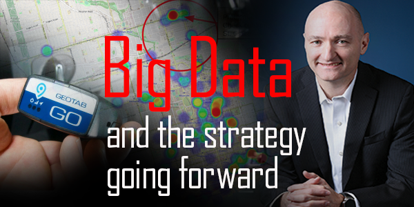
Fleet Equipment caught up with Neil Cawse, Geotab’s chief executive officer, for an update on the acquisition, a look at the shifting landscape of the truck telematics segment and Geotab’s strategy going forward.
FE: Hey Neil, thanks for taking the time to talk. Okay to jump right into it?
Neil: Sounds good. Yeah, man.
FE: Great. So the BSM Technologies acquisition—why is the government segment such a big focus for Geotab? I know you’ve been involved in smart city planning with the likes of Chicago and New York. What does this acquisition bring to the table?
Neil: What was interesting for us was that the first bit of government work that we had was when President Trump pulled out of the Paris Climate Accord. That following week, we had New York and California reach out to us and say, ‘Listen. We’re doing our own thing here. We want to use technology to help us kind of manage our feed, make sure we’re not over-idling, and monitor fuel consumption, etc.’ Maybe it was a coincidence, but I don’t think so.
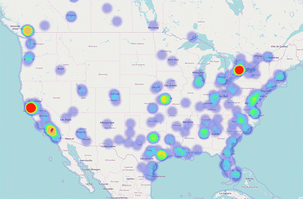
So New York City rolled out 17,000 Geotab devices. And the whole state of California has gone to Geotab, and not just state or local––absolutely everything. We’re seeing that the state of Utah moved to us; the state of South Carolina; big cities all over the place have all switched to Geotab. And it’s about productivity, efficiency, utilization, safety; it’s about smart cities.
We’ve seen some really cool projects that are coming up and the latest is: ‘How are we going to manage trucks moving to our city?’ Some cities look at tuning the traffic lights so that the trucks don’t have to stop––reprogramming all the traffic lights to optimize traffic, because now we have proper traffic flow rate.
FE: Very cool. On the BSM side, what data sets or technology do they have now that you’ve acquired that will help drive more of these applications?
Neil: BSM–they understand the industry and the government markets. Before the acquisition, they had decided that they were going to ‘value add’ and build on top of the Geotab platform and partner with Geotab rather than compete. They’d already done half of the work we needed to do to integrate the companies, because they had already worked on these projects. They have a compliance module, safety module and an operations module that builds on the Geotab data.
On top of that, literally every single rail company in North America uses BSM. The opportunity for us is: If all of the North American rail companies have standardized on BSM, then we say, ‘Why can’t we have all of the rail companies everywhere in the world?’ They all deal with the same issues.
FE: It opens up opportunities for intermodal customers for sure.
Neil: Yeah. Really, if you think about freight starts, maybe with shipping containers, and then you have trucks and rail. So, you can see where this is ultimately going to go. You want to be able to track all goods, wherever they are, at any time or place. And, I think, there’s going to be lots of opportunity for companies that can provide the tracking from the container that gets loaded in Singapore, via satellite tracking, all the way through to the ports for pickup, including managing freight in the ports.
FE: Right, and if you look at something like Volvo is doing with its automated trucks, that information would be a key part of being able to get the vehicles where they need to go.
Neil: Absolutely, that’s the next level I think. When you start introducing autonomous vehicles into the equation, now you’re going to need to use the autonomous vehicle you purchase from one manufacturer and one from another manufacturer and make them work together. You’re going to be able to direct those autonomous vehicles, control what loads are being carried on autonomous vehicles, where they are, if they’re broken down, and whether they are in the right place, will they encounter traffic, and what’s happening with them?
There’s more opportunity because you need to manage all of that. So, we’re quite excited to see how that progresses. It’s early days, but it certainly will come in the future.
FE: Definitely. When we last spoke about seven months ago, Geotab was developing machine learning-driven benchmark applications. What are the latest developments within that segment of the company?
Neil: It’s going really well. There are two things that I’m quite excited about. One of them is, we actually launched in the latest version of My Geotab benchmarking where you can see how your fleet compares with other fleets. We take in all of the data from all of the vehicles on our platform and use machine learning to automatically identify how the vehicle is applied— i.e. is this vehicle is actually a long-haul vehicle, or does this vehicle do home deliveries, or is the vehicle a police vehicle, or a school bus. You can see how you are running your fleet compared to how other people run similar fleets. You can actually see it in My Geotab—fuel consumption curves for your type of vehicle, for example.
The other one that’s about to go into production is related to a truck’s electrical system. What large fleets will tell you is that 80% of the reason why a truck fails in the field is because of the electrical system—alternator or batteries. With machine learning, we’re able to profile the battery curves and figure out if a vehicle is going to fail. The great thing for a fleet is instead of them changing batteries every six months no matter what because they couldn’t take the chance that the vehicle was going to fail, this application will tell them when they need to change their battery with 99.8% accuracy.
FE: How do you do that? Is that application data or are you also bringing in weather data, route data, that kind of thing?
Neil: We pull in the voltage data because that’s what you use when you crank the engine, but we found that data wasn’t reliable enough on its own. So we pulled in other data points: Ambient temperature and oil temperature for example. And the one that actually worked the best was oil temperature. It’s a good proxy for the load on the engine. So if your vehicle is very cold, you know it’s a Minnesota morning in the winter, and you try and crank it, the load on that engine is very, very heavy. And then, when the engine is warm because you stopped for a quick coffee, it turns over right away.
FE: That’s a cool data correlation.
Neil: Yeah, that’s the interesting thing with what we’re doing. We pull in all of this data and we can’t always guess what data is going to be important. And now the industry is moving toward a data ecosystem, in which we can use the weather data to impact routing or we can help you with preventative maintenance.
When it comes to Big Data, we have lots of data partners. We just ran a Big Data boot camp at Geotab where lots third-party partners came in, and they work in this ecosystem. There are a whole lot of different opportunities around data–more than we could ever handle alone. So, having an ecosystem around that is important.
FE: Excellent. Thanks, Neil, for taking the time to talk today.
Neil: No problem, always a pleasure.
Check out the rest of the July digital edition of Fleet Equipment here.