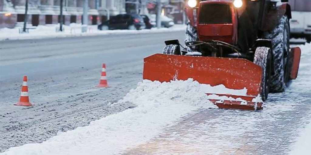
Each year, state and local agencies spend more than $2.3 billion on snow and ice control operations. This winter has been particularly challenging for public works, as severe winter storms have recently swept across much of the United States.
Without accurate visibility into the location and status of their vehicles such as snowplows, it’s difficult for public works departments to clear streets promptly and efficiently—leading to public safety hazards, delays, and calls from dissatisfied citizens. But with the right set of cloud-based tools, public works leaders can gain real-time visibility into their fleet operations—and take action on that data to keep citizens informed.
Samsara has announced three of their newest tools to help public works fleets elevate citizen services, improve public safety, and better utilize taxpayer dollars—during snowstorm season and beyond. These features are the latest additions to Samsara’s suite of tools for public works fleets:
- Coverage Map displays a real-time view of streets traversed by fleet vehicles over a specified time, letting administrators track progress.
- Coverage Map Live Share lets administrators share a publicly-accessible view of the Coverage Map to communicate the status of services delivered to external stakeholders.
- Material Spreader Integration connects data between Samsara and your existing third-party spreader system to maximize material usage and reduce costs.
Plan routes, monitor service coverage with Coverage Map
To maximize service efficiency and strategically plan routes for snow (or other debris) removal, public works administrators need visibility into the location and status of their fleet vehicles at a macro level. With Coverage Map, you can see which roads have recently been serviced and which roads have not. Fleet administrators can monitor the location and activity of any service vehicle on a single pane of glass, accessing data on tagged vehicles, date and time ranges, trips, and more.
Coverage Map allows you to select a group of vehicles and report on different activities including:
- Trip History: See what streets have been traversed and serviced.
- PTO (power takeoff): See roads where PTO was engaged for selected vehicles.
- Material spreader: See where and how much material, such as salt, is being utilized.
Communicate service status to stakeholders
Snowplows, street sweepers, waste vehicles, and other service-based vehicles operate on the front lines with citizens every day. While Coverage Map lets fleet administrators visualize the movement of their vehicles, citizens and other external stakeholders may also need to know when and where service has been executed.
Using Coverage Map Live Share, you can share a publicly accessible URL to view the Coverage Map of any of your tracked services with the click of a button. The map is configurable and can include by date range, tag, panic button, PTO, trip history, expiration date and more. Now, you can drive public visibility for your service status, reduce resident calls, and improve citizen communication.
Minimize material usage and costs
Chemical treatments such as salt and brine are also used for snow removal—in fact, over 15 million tons of salt are used each year to melt away snow and ice. While these materials are often necessary, they can quickly become both costly and environmentally harmful if used inefficiently. For example, salt splits into sodium and chloride when dissolved, contaminating waterways. According to the US Geological Survey, chloride levels were on the rise in 84% of urban streams had high chloride levels, with 29% exceeding federal safety limits of 230 mg per liter.
With this in mind, fleet administrators need to closely monitor material usage to ensure that cost and material waste are minimized. The Samara platform is designed to be compatible with external tools, making it easy to get visibility into the usage of all your assets. Using the Material Spreader Integration, you can seamlessly flow data from your third-party spreader system into your Samsara Dashboard. By using this integration in conjunction with Coverage Map, fleets also gain visibility into service vehicles and road coverage. On your Samsara Dashboard, you can see spreader data such as the rate at which material is being used, material used in blast mode, ambient and road temperature, and more.
Be prepared for snow season and beyond
While snow and other seasonal challenges are often unavoidable, you can ensure that you’re well-prepared with Samsara. These features are just the latest additions to an existing suite of tools Samsara offers to help public works departments manage their diverse fleets—including integrated cameras to capture road conditions and manage safety, as well as features to support preventative maintenance, utilization monitoring, and more.